Maps and Prints Auction / 28 January 2017

82. Plans geographiques de la Pologne et de la Belgique?

Past auctionsMaps and Prints AuctionPlans geographiques de la Pologne et de la Belgique?
return
82
Plans geographiques de la Pologne et de la Belgique?

Plans geographiques de la Pologne et de la Belgique?

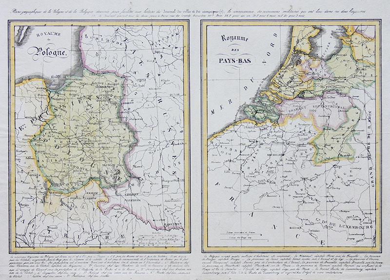
Mapy Królestwa Polskiego i Królestwa Niderlandów, rycina pochodząca z ?Journal des villes et des campagnes ...?, ok. 1842 r.; litografia kolorowana, wym. arkusza 31 x 45 cm

Hammer price
800 zł
Enquire about this item
We are happy to answer any question!
+ 48 58 301 05 54
Treści zawarte w niniejszej witrynie mają charakter wyłącznie informacyjny i nie stanowią oferty handlowej w rozumieniu art. 66 §1 Kodeksu Cywilnego.

Sopocki Dom Aukcyjny Sp. z o.o.

ul. Boh. Monte Cassino 43

81-768 Sopot


58 550 16 05

Bid on-line
with our app!
Google PlayGoogle Playsee more
Newsletter
Join the newsletter and stay up to date!
Sign up